Geography and Geology
Cabo Verde: the eccentric Atlantic archipelago

Along the coast of West Africa, millions of years ago, what would become the archipelago of the Republic of Cabo Verde emerged from the depths of the sea.
This archipelago was built from volcanic debris, mineral and organic materials, sedimented by the strength of the days.
The arid and semi-arid climate divides the seasons in two: the time of breezes and the time of waters.
The rain is scarce, with long periods of drought, but the temperatures, marked by the trade winds, are moderate all year round.
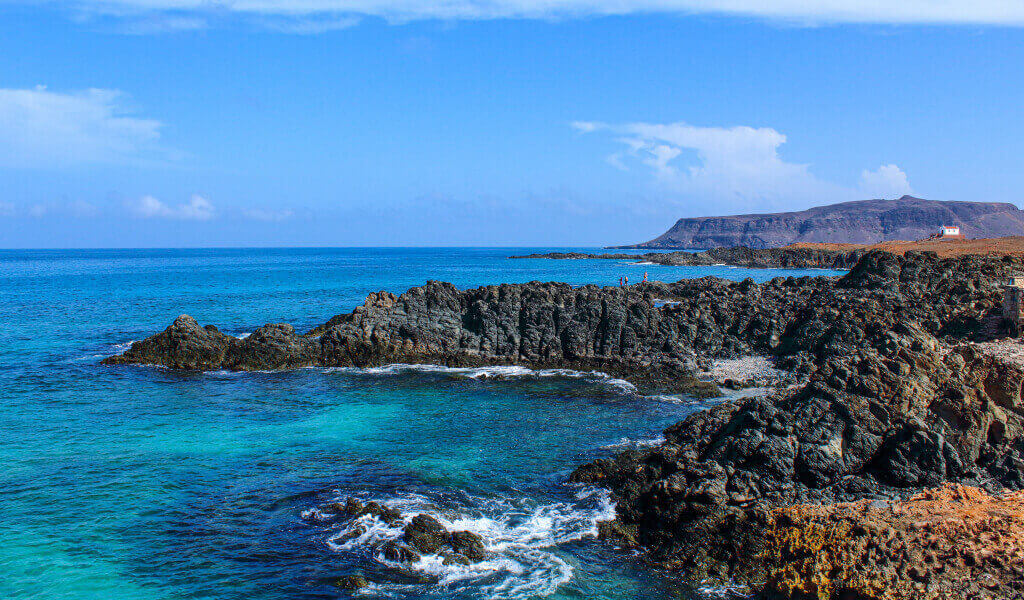
Between the lunar plains, the volcanic vertigo and the immense sea, the particularity of these islands is not easily forgotten.

The islands and islets of Cabo Verde
Cabo Verde is an island country, with an extension of 4033 km², composed of 10 islands, 9 of which are inhabited.
The archipelago is located in the Atlantic Ocean, 455 km off the coast of West Africa, at the same latitude as the Caribbean, and is part of the set of Atlantic islands, alongside the Azores, Madeira, Selvagens and Canarias.
Praia, on the island of Santiago, is the capital. Senegal, Mauritania, Gambia and Guinea-Bissau are the closest neighbors.
Arranged like a boomerang, the islands are divided into two groups due to the northeast trade winds:
the Barlavento (north), and the Sotavento (south).
In the Barlavento group are the islands of:
- Boa Vista,
- Sal,
- Santo Antão,
- Santa Luzia (an uninhabited nature reserve),
- São Nicolau and
- São Vicente.
Also, the islets:
- Branco and Raso, between Santa Luzia and São Nicolau,
- the islet of Birds, on the island of São Vicente,
- the islets Rabo de Junco, off the island of Sal and
- the islets of Baluarte and Sal Rei, in Boa Vista coast.
The Sotavento group consists of the islands:
- Brava,
- Fogo,
- Maio and
- Santiago.
Also the islets of:
- Santa Maria, next to the island of Santiago, and
- Grande, Rombo, Baixo, Cima, do Rei, Luís Carneiro, Sapado and Areia, which are closest to the island Brava.
Santiago, is the largest island, with 991 km², followed by Santo Antão, with 779 km². Brava and Sal are the two smallest islands, with 62.51 km² and 219.8 km², respectively.

The volcanic torrent that brought Cabo Verde to life
All islands in the archipelago are of volcanic origin.
Its formation started 125-150 million years ago, during the Tertiary period.
The islands' relief is rugged, with deep valleys, steep slopes, terraces, well-defined craters and very high peaks.
The exception is the islands of Sal, Boa Vista and Maio, which being the oldest, are now flatter and more arid, with remains of volcanic devices already very worn out.
The highest points are:
- the top of the Crown, on Santo Antão Island, at 1600 m,
- the peak of Antónia, on Santiago Island, at 1819 m and
- the peak of Fogo, on Fogo Island, at 2819 meters altitude.
Most islands have volcanic activity, most of which is unnoticeable.
The risk is low and the eruptions are infrequent, with minimum intervals of decades between them.
Since the settlement of the islands in the 15th century, only the Fogo volcano has been active, with eruptions in the years 1951, 1995 and 2014.
The islands of Santo Antão and Brava have not erupted since the discovery, but they may happen in the future. However, it is not a case to fear.
Between the first signs of volcanic activity and the explosion of magma from the interior of the earth, long months can pass.
This period is sufficient to guarantee safety measures, since all islands are controlled by the seismometric network installed by the National Institute of Meteorology and Geophysics.

The uniqueness of Cabo Verdean fauna and flora
The archipelago is influenced by the Sahel strip, a stretch of land, about 700 km between the desert and the tropical forest, from Senegal to Sudan.
The geographical isolation combined with the hot air masses coming from the African continent, distinguishes Cabo Verde of the other Atlantic islands.
The dry climate of tropical temperature and short periods of rain give it particular climatic, geological, marine, botanical and zoological characteristics.
Among the main fauna species, endemic birds stand out, such as:
- the "passarinha",
- the "calhandra" of Raso Islet,
- the "cagarra" or the "guincho".
The marine fauna is diversified and works as tourist attraction, with several:
- resident fish,
- endemic crustaceans, such as pink lobster, and
- protected species such as humpback whales, dolphins and sea turtles.
As for the flora, there are:
755 plant species, concentrated in areas protected by the archipelago, of which:
- 224 are indigenous and
- 92 are exclusive to Cabo Verde.
The uninhabited island of Santa Luzia and all the islets of the archipelago are essential nature reserves for the preservation of species.
There are also accessible natural parks:
- Cova,
- Paul,
- Ribeira da Torre (Paúl),
- Fogo Island (Fogo),
- Serra da Malagueta (Assomada - Sta. Catarina),
- Barreiro and Figueira (Barreiro),
- Monte Verde (Mindelo),
- Moroços (Ribeira Grande),
- Rui Vaz and Pico de Antónia (Rui Vaz ),
- Top of Coroa (Santo Antão),
- Monte Gordo (São Nicolau) and
- North (Boa Vista).


Explore Cabo Verde
Sun and beach, mountain trails, landscapes of a nature that so easily springs up everywhere and a wealth of customs and traditions that does not translate into any price: Cabo Verde is a paradise that rests by the sea.
With the morabeza of the people and the magic that is only found in Islands of sun and sea, this archipelago is a universe of experiences to discover.


